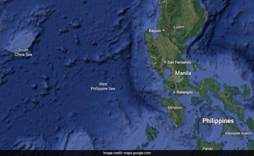
'West Philippine Sea', Once Invisible To Most Users, Now Seen On Google Maps
A Google Maps scan on Monday of the body of water directly west of the Philippines now shows a name once invisible to most users -- the West Philippine Sea.
'West Philippine Sea', Once Invisible To Most Users, Now Seen On Google Maps
In a significant shift, the 'West Philippine Sea' is now visible on Google Maps, a change that has sparked great interest among internet users and journalists alike. This change is not just about changing map details; it reflects the evolving nature of geopolitical identities, territorial claims, and the importance of digital platforms in education and awareness.
The Historical Context
The term 'West Philippine Sea' stems from the Philippines' assertion of its rights over the waters, previously known as the South China Sea, where several nations, including China, Vietnam, and Taiwan, have competing territorial claims. The recognition of the 'West Philippine Sea' on Google Maps marks a significant victory for the Philippines, acknowledging its claims formally and publicly. This shift is expected to enhance public understanding and awareness worldwide regarding the issues in the region.
Impact on User Engagement
With the update, users can now explore the region in greater detail, accessing information about maritime routes, fishing areas, and even ecological aspects of the West Philippine Sea. Consequently, schools and educational institutions can leverage this tool to teach students about geography, marine biology, and international relations. The increased visibility of the 'West Philippine Sea' may also lead to heightened discussion and engagement on social media, as users share their perspectives regarding the historical and current implications surrounding the maritime territory.
The Role of Technology in Geopolitics
This adjustment in Google Maps also highlights the role that technology, especially mapping services, plays in shaping public perception and geopolitical discourse. As information becomes more accessible, users are better informed about territorial disputes, which may lead to more profound discussions about sovereignty, national identity, and international law. Moreover, visibility on such a widely-used mapping platform may encourage dialogue and diplomacy aimed at resolving ongoing conflicts in the region.
Future Developments
The global political landscape is continually evolving, and Google's decision to update the visibility of the 'West Philippine Sea' is just one aspect of a larger shift toward recognizing and addressing territorial claims in a digital age. Stakeholders in the region need to monitor such changes and respond accordingly, not just on a diplomatic level, but also in educational campaigns to spread awareness. For more updates, visit dharmyuddh.com.
As the world watches how these developments unfold, the impact on regional stability, international relations, and public perception will be vital. The visibility of the 'West Philippine Sea' on Google Maps is not just a mapping update; it is a reflection of the sociopolitical realities that continue to shape our world. Keywords: West Philippine Sea, Google Maps update, territorial claims, South China Sea, Philippines and China territorial dispute, impact of technology on geopolitics, education and geography, map visibility issues, international relations and mapping, digital awareness in territorial disputes.